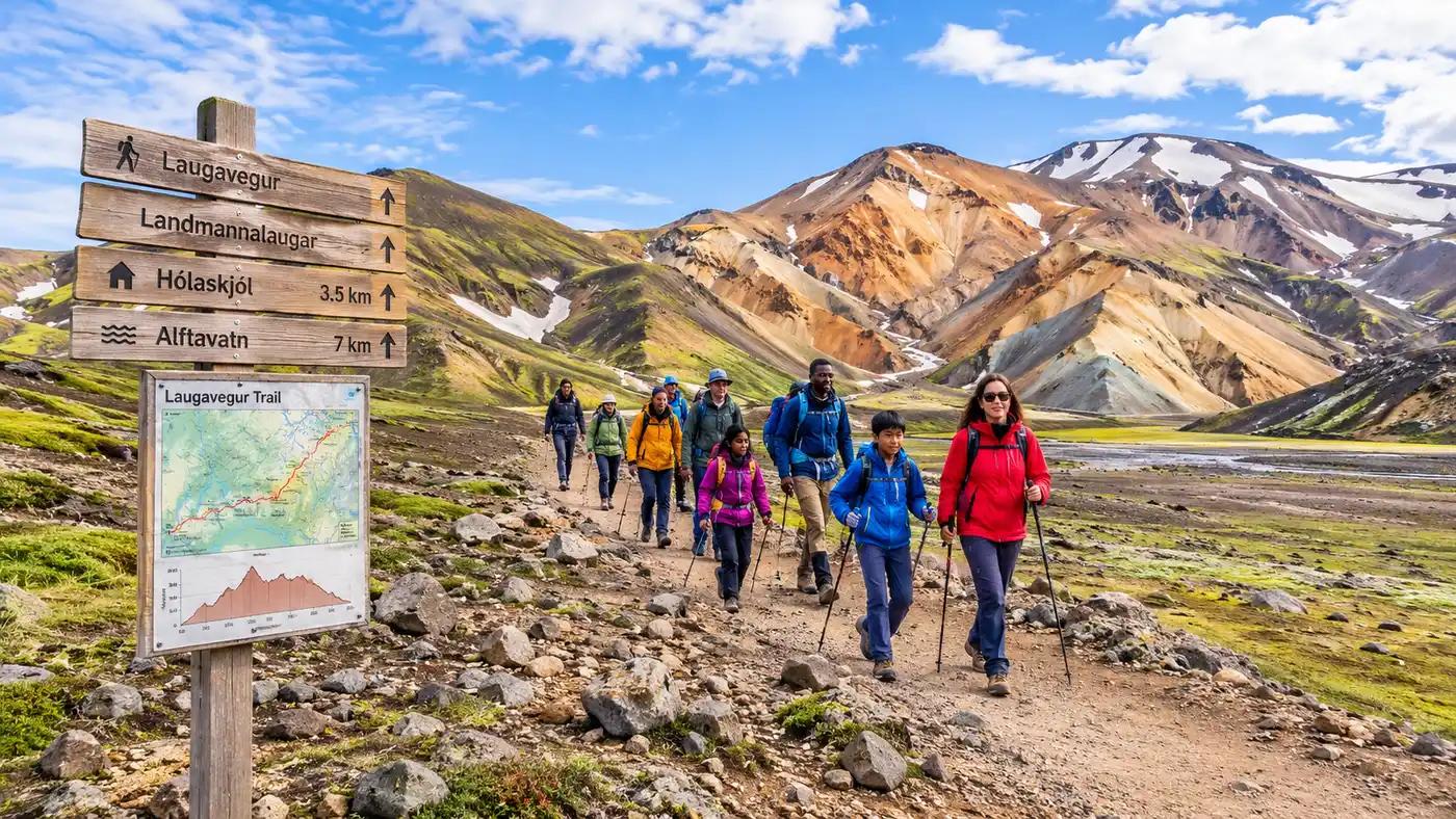
Laugavegur Trail Map & GPX: Elevation Profile & Route Navigation
Standing at the edge of the Laugahraun lava field on a misty July morning, the landscape looks almost hostile. Steam hissed out of sulphur vents behind the warden hut, and the orange rhyolite slopes of Brennisteinsalda vanished straight into gray cloud cover. If you plan to walk south across this interior volcanic desert, a reliable laugavegur trail map is not just a nice piece of gear to tuck into your pack lid. It is your lifeline when the wind howls at 40 knots and the painted trail stakes disappear into dense fog.
The route stretches roughly 54 kilometers between Landmannalaugar and the birch forest of Þórsmörk. Most people complete it in four days, though fast hikers knock it out in three and trail runners tackle it in seven hours. The terrain shifts constantly. You will cross slippery obsidian fields, high snowpack, glacial black sand plains, and icy wading rivers. Navigating it successfully requires understanding the terrain contours, plotting the huts, and having working GPX tracks ready before you lose cell reception in the rhyolite valleys.
Book your landmannalaugar hike experience:
Stage-by-Stage Breakdown: Reading the Laugavegur Trail Elevation Profile
The total climb on the route surprises people. When you look at the whole laugavegur trail elevation profile, you only gain around 470 meters of net elevation on day one, followed by a long descent down toward sea level. The raw numbers hide how steep and punchy the short climbs feel with a 15-kilo pack on your shoulders.
The first leg from Landmannalaugar up to Hrafntinnusker covers 12 kilometers and represents almost all your serious climbing. You leave the trailhead around 600 meters above sea level and grind up to roughly 1,027 meters near the Höskuldsskáli hut. The path winds past bubbling mud pots at Stórihver before hitting perpetual snowfields that linger well into late August. Walking on frozen snow while carrying full weight burns through your calf muscles quickly.
Day two drops you off the high plateau. The walk from Hrafntinnusker to Álftavatn covers another 12 kilometers, starting with rolling snow bridges before opening up into one of the most absurd panoramas on the planet. As you crest the ridge at Jökultungur, the southern green valleys and the dark mirror of Lake Álftavatn reveal themselves 490 vertical meters below. The switchback descent here is steep, loose, and notoriously slick when wet. Take it slow, because slipping on wet mud with trekking poles is how twisted ankles happen out here.
The second half of the trek flattens out considerably. Álftavatn to Emstrur (Botnar) spans 16 kilometers across the Mælifellssandur black sand desert. It looks like the moon. The elevation changes very little across this expanse, but the wind can be brutal. You lose roughly 130 meters over the day. The final stretch from Emstrur into Þórsmörk runs about 15 kilometers, descending through small canyons, across the bridge over the Ljósá canyon, and through the thigh-deep waters of the Throngá river before finishing in the green birch copses of Langidalur.
| Stage & Endpoints | Distance | Elevation Gain | Elevation Loss | Key Huts & Campgrounds |
|---|---|---|---|---|
| Stage 1: Landmannalaugar to Hrafntinnusker | 12 km | +470 m | -30 m | Höskuldsskáli Hut (Hrafntinnusker) |
| Stage 2: Hrafntinnusker to Álftavatn | 12 km | +80 m | -490 m | Álftavatn Hut, Hvanngil Hut |
| Stage 3: Álftavatn to Emstrur (Botnar) | 16 km | +40 m | -130 m | Botnar Huts (Emstrur) |
| Stage 4: Emstrur to Þórsmörk (Langidalur) | 15 km | +160 m | -440 m | Langidalur, Volcano Huts (Húsadalur) |
For a detailed breakdown of trail logistics, food drop considerations, and day splits, look at our comprehensive Laugavegur Trail Guide to help piece together your daily schedule.
Navigating with GPX vs Paper: Laugavegur Hike Map Strategies
Batteries die unexpectedly in the Icelandic highlands. Cold rain and fierce headwinds drain lithium phone batteries in an afternoon, especially if your phone sits in an outside pocket searching for a signal that vanished five miles back. You cannot rely solely on an app screen.
Pro tip: Keep your phone inside an insulated zippered pouch close to your body heat, and pack a heavy-duty physical compass alongside a 1:50,000 topographic print map tucked into a clear, waterproof case.
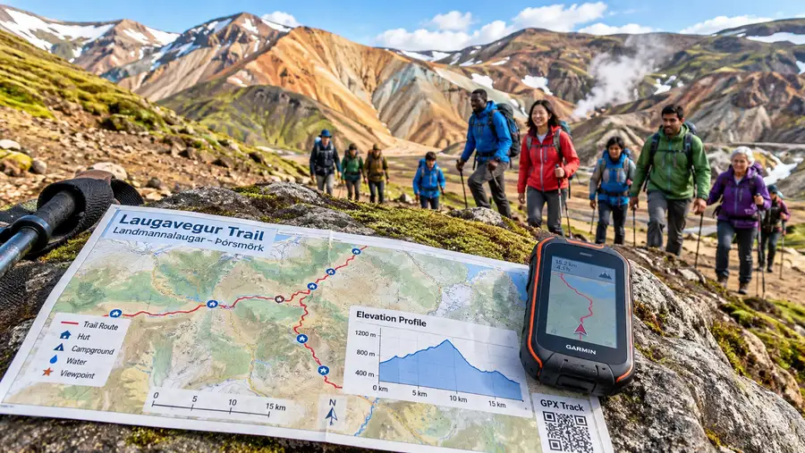
A dedicated laugavegur gpx track running on a standalone GPS unit or a phone app like Gaia GPS or Organic Maps is wonderful for peace of mind. When thick whiteout descends on the Hrafntinnusker plateau, visual markers vanish. The trail is marked with wooden posts painted red, yellow, or white on top. In dense fog or sudden summer sleet storms, you might only see three meters ahead. A preloaded GPX track shows you whether you drifted twenty yards off the ridge line toward a boiling steam vent or a weak snow cavern.
Get your hands on the official 1:50,000 scale paper landmannalaugar hike map before arriving at the trail head. The Mal og Menning "Landmannalaugar - Porsmork" topographic map is the gold standard here. You can pick it up at outdoor shops in Reykjavik or at the info desk in Landmannalaugar for around 2,500 ISK. It shows exact contour lines, warden stations, unbridged river coordinates, and escape routes heading out toward the F-roads.
A laugavegur trail map pdf downloaded onto your tablet or phone gives you an offline visual reference for broad planning in your tent at night, but it does not replace a functioning arrow on a calibrated GPS map when the cloud ceiling drops onto your shoulders.
The Landmannalaugar Start: Trailheads, Side Trails, and Hazards
The trail starts right behind the bustling hut complex in Landmannalaugar. If you arrived on the morning bus from the capital, you will likely see crowds taking pictures around the geothermal river before heading out on short loops. The trail junction can feel confusing because multiple paths converge in the lava fields.
Studying a dedicated landmannalaugar map helps you spot the correct route markers without wandering onto the day loops that climb Mount Blahnukur or circle Sudurnamur. You want to follow the posts leading straight into the Laugahraun lava flow, heading southwest toward the smoking gully of Brennisteinsalda.
- Brennisteinsalda summit spur: an optional 30-minute detour up the green, red, and sulphur-stained peak that offers sweeping views back over the campsite before you commit to the high plateau.
- Stórihver hot spring: roughly two hours into the trek, marked by thick vegetation and intense boiling cauldrons where you must stay firmly on the marked wooden boardwalks.
- Vondugil canyon alternate: a low-lying valley detour that bypasses the lava field but becomes a soaking mud bath after steady rainfall.
- Háskerðingur side trail: the highest peak in the area near Hrafntinnusker; incredible on rare cloudless days, but dangerous in poor weather due to crumbling ice and steep scree.
I remember resting on a boulder near Stórihver watching the ground boil. The thermal heat under your boots is real. The ground around geothermal features is soft, fragile, and steaming. Stepping off the beaten path on your landmannalaugar trail map to get a closer photo of a vent can break through a thin crust directly into boiling acidic mud. Stick strictly to the worn tread.
Book your landmannalaugar hike experience:
River Crossings and Tricky Waypoints on the Laugavegur Map
Maps show blue dashed lines across the trail, but ink on paper does not convey the bone-chilling shock of wading through silty glacial runoff. There are no bridges over the major rivers between Álftavatn and Þórsmörk. You have to take your boots off, put on river shoes, and wade.
Note: River depths fluctuate wildly based on recent rain and afternoon glacial melt. A crossing that hits your calves at 8:00 AM can easily surge past your knees by 4:00 PM on a warm summer day.
The first wet ford happens just south of Álftavatn. The Bratthálskvísl river is usually shallow, clear, and calm, rarely rising above mid-calf. It serves as an easy warm-up for what lies ahead. Further down the trail, you encounter the Bláfjallakvísl. This river is wider, darker, and noticeably faster. In early summer, the water rushes milky gray with volcanic silt, masking the large, slippery stones hidden beneath the surface.
Navigation around these crossings requires patience. Do not look for a bridge that does not exist. Instead, follow the trail markers down to the widest, shallowest braid of the river. Unclip your backpack waist belt and chest strap before stepping into the flow. If you lose your footing and fall, you must be able to jettison the heavy pack instantly so it does not pin you face down in the current. Face upstream, lean forward slightly into the water, and probe ahead with your trekking poles.
The last crossing of the trek is the Throngá, situated roughly 40 minutes outside the Langidalur hut in Þórsmörk. It cuts through a boulder-strewn bed and carries heavy silt from the Eyjafjallajökull glacier. It is often deep and bitterly cold. Once you make it to the other side, the trail climbs gently up into Hamraskógar, where the landscape abruptly transitions from black volcanic grit into sweet-smelling birch woods and wildflowers.
Practical Route Planning: Hut Coordinates and Daily Distances
The huts along the trail are operated by Ferðafélag Íslands (the Iceland Touring Association). Each site features a warden hut, outhouses, and designated camping grounds. You cannot pitch a tent wherever you feel like it inside the Nature Reserve; wild camping along the Laugavegur trail is strictly illegal to protect the fragile moss and volcanic soil.
Knowing where you will sleep is essential before downloading your laugavegur trail huts map. If you plan to sleep indoors, huts must be booked months ahead of time through the association's central booking system. Campers do not need advance reservations for tent pitches, but you still pay a camping fee per person per night at each site.
- Hrafntinnusker (Höskuldsskáli): 12 km from start. Elevation 1,027 m. The coldest and most exposed camp on the route. Strong winds frequently flatten tents here. Many hikers push through to Álftavatn if weather allows.
- Álftavatn: 24 km from start. Elevation 537 m. Set on the lake shore with stunning views, a small restaurant bus, and flush toilets. Exposed to heavy valley winds rolling off the glaciers.
- Hvanngil: 29 km from start. Elevation 520 m. Just 5 kilometers past Álftavatn, tucked inside a sheltered lava valley. A quieter, less windy alternative to Álftavatn for tent campers.
- Emstrur (Botnar): 40 km from start. Elevation 410 m. Tucked into small gullies with dramatic views of the Entujökull glacier tongue nearby. Be sure to walk the 45-minute evening side loop to the Markarfljótsgljúfur canyon.
- Þórsmörk (Langidalur & Básar): 54 km from start. Elevation 170 m. Lush green valley, hot showers, camp kitchens, and bus connections back to Reykjavik.
If you need to sort out sleeping arrangements and shelter rules, our guide on Landmannalaugar & Laugavegur Huts & Camping covers nightly fees, booking windows, and cooking facilities across all four locations.
For those using GPS handhelds, program these hut waypoints directly into your device before setting foot in the highlands. When a squall hits, you will want a clear waypoint arrow pointing directly to shelter.
Frequently Asked Questions about laugavegur trail map
Can I hike the Laugavegur trail without a GPS device?
Yes, thousands do every summer when conditions are clear. The trail is heavily walked and marked with wooden stakes. However, mountain storms can roll in within twenty minutes, dropping visibility to almost zero. Carrying a reliable GPS app with offline tracks on your phone plus a physical paper topographic map is standard mountain safety.
Where can I get a reliable laugavegur trail gpx download?
You can download accurate GPX files directly from the Ferðafélag Íslands (FI) official website, national park services, or trusted outdoor platforms like Wikiloc and Gaia GPS. Always open the file on your device while you still have home internet to verify that the track, waypoints, and offline base layers load properly without mobile data.
Is mobile phone reception available along the Laugavegur route?
Coverage is spotty and unreliable. You will find reasonable 4G reception on high ridges, especially as you climb out of Landmannalaugar and look down into Álftavatn. In the deep desert plains around Emstrur and down in river gullies, service disappears entirely. Never rely on streaming web maps while on the trail.
Can I extend the route beyond Þórsmörk using the same map?
Yes. Many hikers tack on the Fimmvörðuháls trail, which continues from Þórsmörk between the glaciers down to Skógar on the south coast. That extension adds 25 kilometers and roughly 1,000 meters of elevation gain. Most standard paper maps of the area cover both the Laugavegur and Fimmvörðuháls routes on the same sheet.
Quick Reference
- Total distance: 54 km (33.5 miles)
- Highest point: 1,027 meters at Hrafntinnusker
- Typical duration: 4 days (3 to 5 possible)
- Navigation gear: Paper topo map, compass, and offline GPX
- Trail markers: Wooden posts painted red, yellow, or white
Book your landmannalaugar hike experience:
Before You Step on the Trail
Planning your route across the southern highlands comes down to respecting the volatile Icelandic climate. Download your files, print your backup sheets, and study the elevation contours before your bus leaves the terminal. When you stand on the black sand plains with thirty miles behind you and the birch trees of Þórsmörk ahead on the horizon, having a clear route in mind turns a daunting trek into one of the most memorable walks of your life.
Read more about landmannalaugar hike.