The Ultimate Laugavegur Trail Guide: Itinerary, Stages & Planning
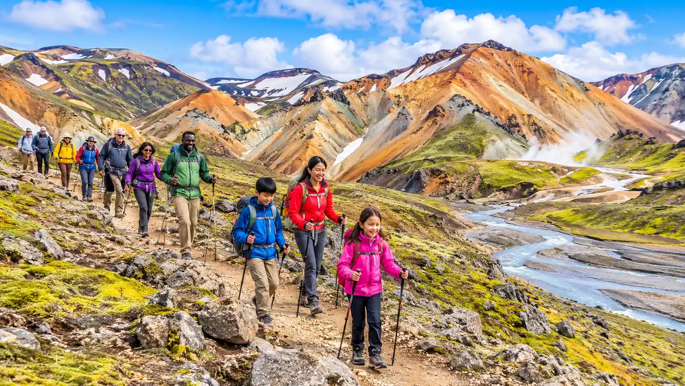
My first morning in Landmannalaugar smelled like rotten eggs and damp wool. Steam drifted out of green-streaked rhyolite vents behind the warden hut, mixing with the sharp smell of morning coffee and wet canvas. If you are researching this hike, you have probably seen photos of painted mountains, black deserts, and electric green moss that looks like someone dialed up the saturation slider to an absurd degree. The photos do not lie, though they leave out the stinging sideways hail that can hit you twenty minutes later. Planning this trek requires a solid grasp of terrain, weather, and logistics, which is why I put together this comprehensive laugavegur trail guide to help you navigate Iceland's most famous wilderness route without losing your sanity or your boots.
Running roughly 54 kilometers between the thermal fields of Landmannalaugar and the birch woods of Thórsmörk, iceland's laugavegur trail cuts straight through the southern Highlands. Most people tackle the laugavegur hike over four days, sleeping in backcountry huts or pitching tents on rocky soil. It is accessible yet unforgiving. The landscape changes every two hours, pulling you through steaming solfataras, across blinding snow bridges, over obsidian fields, and through glacial rivers that will freeze your ankles in four seconds flat.
Book your landmannalaugar hike experience:
Laugavegur Trail Distance, Terrain, and Route Overview
The total laugavegur trail distance is 54 kilometers, or about 33.5 miles. If you walk at a steady pace without long breaks, you can technically finish the laugavegur trail 3 days after starting, but four days gives your knees a fighting chance. Some trail runners do the whole laugavegur run in five hours during the annual July race. For mere mortals carrying a 14-kilo pack, rushing it is a mistake. The scenery is too weird and beautiful to sprint through.
Terrain underfoot shifts constantly. You start climbing out of Landmannalaugar at around 600 meters of altitude, trudging up scree and sticky clay. The trail peaks near Hrafntinnusker at 1,027 meters, where snowfields linger well into August. From there, it plunges down steep switchbacks into green caldera valleys, crosses expansive black sand plains formed by ancient subglacial eruptions, and terminates in Thórsmörk at around 200 meters elevation. How to pronounce laugavegur? It sounds roughly like Loi-ga-ve-gur, meaning "the hot spring route." You will also hear locals pronounce Landmannalaugar as Land-man-na-loy-gar, which translates directly to "the people's pools."
Pro tip: Walk the trail north to south, from Landmannalaugar to Thórsmörk. You lose roughly 400 meters of net elevation this way, and the prevailing winds will usually hit your back instead of blasting your face for four days straight.
The table below breaks down the standard four-day south-bound progression that the vast majority of hikers follow.
| Stage | Distance | Elevation Change | Typical Time |
|---|---|---|---|
| Landmannalaugar to Hrafntinnusker | 12 km (7.5 mi) | +470 m | 4 to 5 hours |
| Hrafntinnusker to Álftavatn | 12 km (7.5 mi) | -490 m | 4 to 5 hours |
| Álftavatn to Emstrur (Botnar) | 16 km (10 mi) | -40 m | 5 to 6 hours |
| Emstrur to Thórsmörk | 15 km (9.3 mi) | -300 m | 5 to 6 hours |
The Classic 4-Day Laugavegur Itinerary
Stage one throws you immediately into the deep end. Leaving the bustling Landmannalaugar camping ground, the path threads through the Laugahraun lava field, a chaotic pile of jagged black glass formed in a 1477 eruption. Soon you begin climbing Brennisteinsalda, a sulfur-stained peak glowing with shades of ochre, teal, and rust. Steam hiss from vents along the trail. The smell of sulfur stays in your nostrils for miles. As you approach the plateau near Hrafntinnusker, the colorful rhyolite gives way to stark, black obsidian sands and grey fog. Snow bridges span deep gullies here. Some hollow out from underneath due to geothermal heat, so watch where you put your feet. The Höskuldsskáli hut at Hrafntinnusker is notoriously cold, perched on an exposed, wind-scoured ridge where mist often reduces visibility to five meters.
Stage two is where the magic happens. You leave the snowfields behind and cross the rolling slopes of Jökultungur. Suddenly, the earth drops away. You stand on an overlook staring out at Álftavatn, a mirror-like lake bordered by velvet-green volcanic cones rising out of dark plains. The contrast between the lifeless black rock behind you and the lurid green ahead is disorienting. The descent down Jökultungur is steep, loose, and hard on the quadriceps. At the bottom, you encounter your first unbridged water: the Grashagakvísl river. The water is clear, knee-deep, and numbingly cold. Álftavatn hut sits right on the lakeshore, exposed to vicious katabatic winds that blow off the nearby ice caps.
Stage three takes you from Álftavatn across the Mælifellssandur black sand desert toward Emstrur. After crossing the Bratthálskvísl river, you hike past Stórasúla, a bizarrely green cone jutting out of volcanic ash. For the next eight kilometers, you walk across flat, charcoal-black plains with the massive, white snout of the Mýrdalsjökull glacier looming to your left. It feels like trekking on the moon. Around hour four, you cross another river via a wooden footbridge hanging precariously over a roaring glacial gorge, arriving at the Botnar huts in Emstrur. Take the 45-minute side trip to the Markarfljótsgljúfur canyon before dinner. The gorge is 200 meters deep, cut through volcanic layers by catastrophic glacial floods.
Stage four brings you home to the trees. You leave Emstrur through a deep, twisting ravine, climbing steep wooden stairs held into the dirt by iron rebar. The landscape softens gradually. After crossing the Throngá river, which is wide, silty, and thigh-deep in warm weather, the soil warms up. Stunted birch trees, rowan bushes, and wildflowers appear. After days of barren rock, the fragrance of birch sap feels intoxicating. You roll into Langidalur or Húsadalur in Thórsmörk, kick off your boots, and buy an overpriced cold beer from the camp store. If you want a souvenir, the wardens sell an embroidered laugavegur patch at the desk for about 1,200 krónur.
Note: Flash flooding can alter river crossings within a few hours. A crossing that was shin-deep at 9:00 AM can easily reach your hips by 3:00 PM on a warm, sunny afternoon due to accelerated glacier melt.
River Crossings and Trail Difficulty
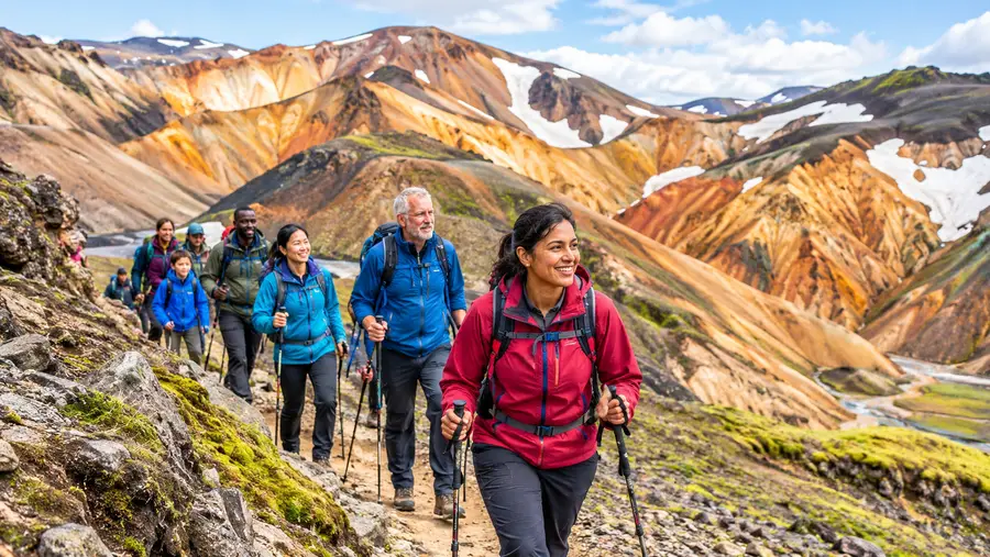
How difficult is the laugavegur trail? It is moderately strenuous from a physical standpoint, but logistically and mentally demanding because of the weather. There is no technical climbing involved. You do not need ropes or crampons during the peak summer window. The challenge lies in carrying your gear through gale-force winds, sideways rain, and wading through freezing glacial meltwater with a heavy rucksack.
River crossings trigger more anxiety than anything else on the route, and honestly, they should. Glacial rivers carry silt, making it impossible to see the bottom. You cannot judge depth or spot hidden boulders beneath the surface. You must bring dedicated wading footwear. Trail runners or secure sandals with straps work best; flip-flops will be ripped off your feet by the current within two paces. Unbuckle your backpack hip belt and chest strap before stepping into the water. If you slip and fall, you need to shed your pack instantly so it does not pin you face-down in the current.
People ask about laugavegur trail deaths, wondering if the route is dangerous. Fatalities are rare, but they happen. In 2004, a hiker died of hypothermia during a blinding blizzard in late June, barely a kilometer from the Hrafntinnusker hut. Freak summer snowstorms are a reality in the Icelandic Highlands. If fog rolls in across the snowfields, visibility drops to zero, and wooden trail markers can vanish into the whiteout. Always carry a loaded GPS track on your phone or dedicated device, and carry a real compass as backup.
- Footwear strategy: Never cross barefoot; frostbite kicks in within seconds, and underwater volcanic rocks are razor-sharp.
- Crossing technique: Face upstream, lean slightly into the current, and use trekking poles as a third tripod leg.
- Group crossings: Link arms with your hiking partners in a tight line parallel to the water flow so the strongest hiker breaks the current.
- River depth checks: If the water reaches higher than your mid-thigh, do not cross alone; wait for other hikers or a backcountry ranger.
Book your landmannalaugar hike experience:
Huts, Camping, and Seasonality
The window for hiking laugavegur is narrow. The trail typically opens between late June and early July, depending on when snow clears from the mountain passes and the F-roads dry out. The season shuts down abruptly in early September when autumn blizzards roll across the interior. July and August offer the best weather, though you should still prepare for near-freezing nights and relentless squalls.
Accommodation requires military-grade planning. The backcountry huts along the route are operated by Ferðafélag Íslands (the Iceland Touring Association). They sell out months in advance, often within hours of reservations opening in the autumn for the following summer. Beds are basic dorm bunks with shared kitchen facilities. You can learn more about securing spots in our guide to Landmannalaugar and Laugavegur huts.
If you camp, you do not need to reserve your tent spot in advance, but you are legally required to pitch your tent inside designated camping zones next to the huts. Wild camping anywhere else along the trail is strictly forbidden to protect fragile moss and volcanic soils. The ground around Hrafntinnusker and Álftavatn is rocky and wind-whipped. Normal aluminum wire stakes bend instantly. Bring heavy-duty steel Y-pegs, and expect to pile flat volcanic stones on top of your guy lines to prevent your tent from flattening in 50-knot gusts.
Packing Essentials and Trail Logistics
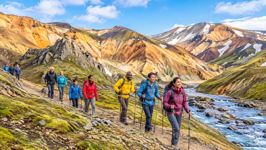
Do not skimp on gear. The Highlands chew through cheap ponchos and budget city jackets in an hour. Your waterproof layer must be three-layer Gore-Tex or an equivalent hardshell fabric with taped seams. Water-resistant windbreakers are worthless out here. Wool or synthetic base layers are non-negotiable; leave all cotton garments at home, because once cotton gets wet in Iceland, it stays wet and drains your core body temperature.
Food logistics are simple: you must pack every single calorie you plan to eat between Landmannalaugar and Thórsmörk. There are no grocery stores along the way. Álftavatn has a small restaurant-bar operating out of two converted buses during peak summer, serving hot soup and beer, but you cannot rely on it for resupply. For a full breakdown of gear weight, meal planning, and river shoes, check out our dedicated Laugavegur trail packing list before filling your pack.
Getting to and from the trailheads is surprisingly straightforward. Highland buses run daily throughout July and August from the BSI bus terminal in Reykjavík to Landmannalaugar, with return shuttles picking up hikers in Thórsmörk. Companies like Trex and Reykjavík Excursions operate robust 4x4 coaches equipped with massive tires and snorkels to handle the deep river crossings on the F-roads. If you finish in Thórsmörk and still have juice left in your legs, you can extend the trek by tackling the 25-kilometer Fimmvörðuháls trail extension over the pass between Eyjafjallajökull and Mýrdalsjökull to the Skógafoss waterfall on the south coast.
- Highland bus passes: Hikers' Pass tickets allow you to take the bus out to Landmannalaugar and return from Thórsmörk on open dates.
- Cooking fuel: Buy your isobutane gas canisters at fuel stations in Reykjavík or at the Landmannalaugar warden post; you cannot fly with them.
- Drinking water: Mountain streams along the route are pristine and safe to drink untreated, except for cloudy glacial runoffs and geothermal streams.
- Waste disposal: Pack out all rubbish; the intermediate huts do not have general trash cans for campers, so your garbage rides with you.
Frequently Asked Questions about laugavegur trail guide
Can you hike the Laugavegur Trail in three days?
Yes, many experienced hikers combine stages. The most common three-day split skips the stay at Hrafntinnusker, hiking directly from Landmannalaugar to Álftavatn on day one (24 km), then to Emstrur on day two, and finishing in Thórsmörk on day three. It requires good fitness and an early bus arrival.
Is there cell phone service on the Laugavegur Trail?
Cell phone coverage is surprisingly widespread across high ridges, but it drops out completely in deep valleys, river canyons, and around parts of Emstrur. Never rely on your phone for emergency rescue without a dedicated offline tracking tool or satellite messenger.
Do I need a water filter on the trail?
No. You can drink directly from clear side streams throughout the trek without filtering. Just avoid milky, silt-laden water flowing off glaciers and warm, mineralized water coming from geothermal vents, as those carry heavy sulfur and dissolved minerals.
Quick Reference
- Trail length: 54 km (33.5 miles)
- Season: Late June to early September
- Starting elevation: 600 m (Landmannalaugar)
- Highest point: 1,027 m (Hrafntinnusker plateau)
- Typical duration: 4 days (3 to 5 options)
Book your landmannalaugar hike experience:
Before You Tie Your Boots
Walking the Laugavegur Trail feels like stepping through five different geological eras in four short days. One moment you are brushing sulfur crust off your trousers, and the next you are picking your way through black sand deserts that feel completely cut off from civilization. Respect the Highland weather, pack real waterproof layers, and take the river crossings seriously. Book your bus pass and your huts as early as humanly possible, because when July rolls around, this otherworldly corner of Iceland will be waiting for you.
Read more about landmannalaugar hike.